How to find the Cavendish Laboratory
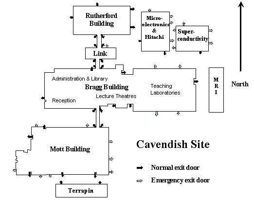
The Cavendish Laboratory is on J J Thomson Avenue off Madingley Road to the west of the city. The SP Group is in the Mott building, but you must visit Reception when you arrive to get a badge and contact the person you are visiting. Coming by car, you must reserve a parking place in advance, through your host and Reception.
Maps
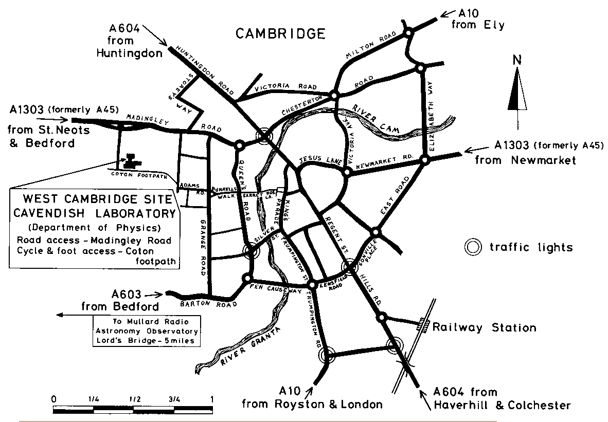
- Sketch map of Cambridge
- Google map of the area near the Cavendish
- Maps of the University
- University map of the region near the Cavendish Laboratory
By Bus from Cambridge
The Stagecoach buses Citi 4 and Uni 4 each run every 20 minutes. Citi 4 starts at the Drummer Street bus station and Uni 4 from Addenbrooke's Hospital, via Brooklands Avenue (near the railway station) and Trumpington St (eg stopping outside Pembroke College and in Silver Street). The timetables can be searched for here (live departures from Drummer Street here).
By Train
Information about the timetable for trains can be found here. Trains run from both King's Cross and Liverpool Street stations in London (trains from King's Cross run twice an hour and are non-stop). Cambridge station is about 3 miles from the Cavendish - it is best to take a taxi (the journey takes 15-40 minutes depending on traffic), but if you know where to catch it (eg in Brooklands Avenue), the Uni 4 bus is also possible.
By Car
You must reserve a parking place in advance, through your host and Reception.
Coming from the South, you will probably come up the M11. Leave at junction 13, turn right along the A1303. J J Thomson Avenue and the Cavendish are on the right after 1 km (look out for a green sign to West Cambridge site).
Coming from the West, you will probably come on the A428 from Bedford. Take the A1303 as you approach Cambridge, and you will be on the Madingley Road, with J J Thomson Avenue and the Cavendish on the right before you enter the city (look out for a green sign to West Cambridge site).
Coming from the North, you should come on the A14. Take the exit for Cambridge, which you enter along the Huntingdon Road. Turn right along Storey's Way, then right when you reach Madingley Road, to find J J Thomson Avenue and the Cavendish on the left.
See the maps above for more details.
By Air
The closest of the London Airports is Stansted. Buses run approximately hourly to Cambridge, taking about 40 minutes. From the bus station it is about a 20 minute walk to the Cavendish (via Burrell's Walk and the Coton footpath - see map), or you can take a taxi. However, there are limited numbers of cities with flights to Stansted.
Heathrow and Gatwick airports are both served by hourly buses to Cambridge. The scheduled journey time is about two hours from Heathrow and three hours from Gatwick. Alternatively, you can take the underground or train from Heathrow or a train from Gatwick to central London, and then a train to Cambridge from King's Cross Station.
How to report problems with road and transport
These web sites help you to report problems to the relevant authority in the hope something may be done about them:
- FixMyTransport.comfor complaining about transport problems.
- FixMyStreet.com for complaining about problems with road (potholes, signs etc).